The Rohil Basmai Valley Trek is yet another revelation. The route is versatile since it unveils something unexpected at every juncture. One moment you’re trekking up a section littered with boulders and suddenly an alpine lake emerges out of the blue, with glacier-filled mountain peaks as its backdrop.
Day 1: Trek from Pahalgam to Aru to Lidderwat
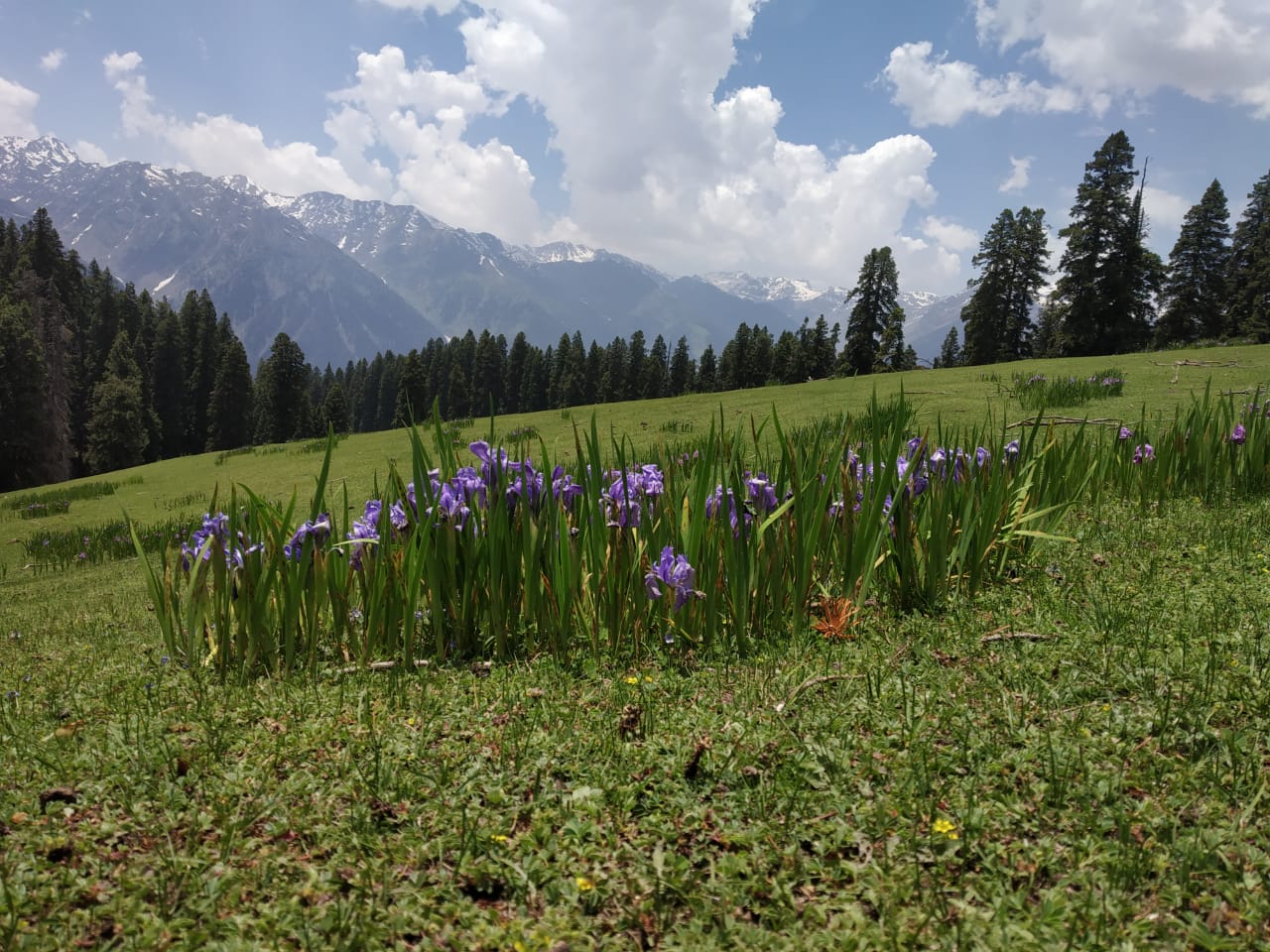
Altitude: 7958 feet to 9131 feet Distance: 10 kms Time taken: 6 hours Trail type: Gently climbing long trail It is a gentle but long climb from Aru to Lidderwat covering a distance of 10 km in 6 hours. The trail to Lidderwat starts to climb straight out of the village, following the course of the Lidder River. Follow the wide trail past the agricultural department’s fence. Look back to take a commanding view of the entire region of Aru. The trail gets into a cluster of fir trees and continues to climb. Half an hour later, the trail pops out at a clearing called Dalla near Gujjar huts. Out of the pine trees, the trail gently climbs a mound, from the top of which is one of the most fascinating sceneries of the day. The Lidder River meets with the trail at the valley bottom, spreading out in springs. Next to the river are grassy glades where the trail runs. Beyond, the Lidder rushes out of a curve around more gorgeous fir forests. It takes about half hour to cross this lovely section of the trail and enter the cluster of firs once again. Across the forest and ten minutes later, are the superb meadows of Lidderwat. There are a few Gujjar huts that signal Lidderwat. A sensible option is to drop down to the wooden bridge, climb out of the meadows on the other side and camp anywhere. On the other side are lovely clear streams running across the meadows – this is vitally important if you are camping for the night. Pahalgam District Authority huts for accommodation. There are also plenty of places to pitch camp.The Lidderwat camping site is a dream. Clear streams run across the meadows. Spare time to take long walks that stretch to either ends of the meadows.
Day 2 Trek from Lidderwat to Satlunjan
Altitude: 9,131 feet to 10,500 feet Distance: 5 kms Time taken: 4.5 hours Trail type: Plain walk with intermittent moderate climbs. Last patch is a steep climb From Khalan to Satlunjan, the 1.5 hour journey is characterized by boulders. The trail also winds along the river. Satlunjan is a big Gujjar village, which houses 15 huts. Satlunjan literally translates to ‘Seven Bridges’, which denotes the 7 bridges to cross 7 mountain streams. From Satlunjan (10,700 feet), the climb towards Rohil Valley is steep. It usually takes an hour to reach the top of the valley, which has a few more Gujjar huts. Camp here for the night.
Day 3 Trek from Satlunjan to Sonasar Lake (Basmai)
Altitude: 10,500 feet to 12,457 feet Distance: 4.5 kms Time taken: 5 hours Trail type: Boulders, grasslands, mountain streams and alpine lakes From the river, it’s a gentle climb from the right side of the river until you reach the boulder patch. Cross over to the other side of the river. Post your crossover, it’s a moderate climb all the way to Sonasar. The alpine lake emerges as a surprise element. The banks of this tranquil beauty will be your campsite for the night.
Day 4 Trek from Sonasar Lake to Handilsar Lake
Altitude: 12,457 feet to 12,103 feet Distance: 7.5 kms Time taken: 6 hours Trail type: Grasslands, mountain streams, boulders, snow patches and alpine lakes This is a good spot to take a breather. From Tsangar, it’s a moderate climb for one hour to reach Handilsar lake. Camp here for the night. Camping near an alpine lake is an experience unlike any other. The night sky is overwhelmingly beautiful.
Day 5 Trek from Handilsar Lake to Rohil Top; trek back to Satlunjan
Altitude: 12,103 feet to 13,000 feet; Descend from 13,000 feet to 10,700 feet Distance: 6.5 kms Time taken: 6 hours Trail type: Meadows, boulders and alpine lake It’s a moderate climb again to Rohil Top via Hapatsar Lake. It’s a 45 minute mild hike to the lake, which is at an altitude of 12,800 feet. Above Hapatsar, the snow patches are bountiful. They feed this alpine lake. The climb to Rohil Top is moderate and it’s the highest altitude of the trek at 13,000 feet. The views from the top are spellbinding. The Rohil Nala flows to the left side of the trail. The Rohil valley is narrow in comparison to the Basmai Valley but beautiful nonetheless. Spend a good one hour at the top and take in the sceneries. Retrace your steps to Satlunjan lower campsite. Camp at Satlunjan for the night.
Day 6 Trek from Satlunjan to Aru to Pahalgam
Altitude: 10,700 feet to 7958 Distance: 14 kms Time taken: 6 hours Trail type: Grasslands and mountain streams Today is a longest day of the entire trek. However, the trail does not pose too many challenges. You will be trekking along lush grasslands that wind through broad-open valleys covered with trees. The route is blessed with mountain streams, which is always a relief. The milky white stream water is fresh and rejuvenating. It’s important that you take short five-minute breaks and hydrate yourself well today. You will be losing an altitude of 2492 feet within a single day and that can be tricky if you don’t pace yourself well. Predominantly, it is a gentle climb. If you get off to an early start, you will reach Aru no later than 3 pm.